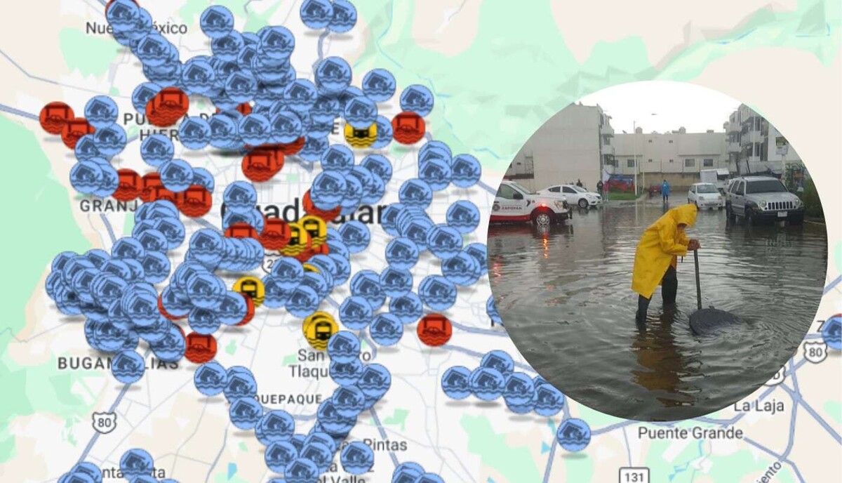
Authorities have intensified preventive measures ahead of the rainy season, relying on the Unique Flood Map developed by Imeplan, which is current until 2025. This map is built using data from Civil Protection, Public Works, and municipal departments, allowing for the guidance of prevention efforts. Similarly, state and municipal authorities have already begun cleaning and desilting pipes and drains to reduce risks during the rainy season.
According to the latest available data, there are various Recurrent Flood Sites (SRI) in the Guadalajara Metropolitan Area (AMG). The identified points include: Tlaquepaque: Calle Pedrera and Prolongación Nuevo México, colonia Las Juntitas; Tonalá: Calle Juan Escutia and Privada San Jorge, colonia Los Amials; Zapotlanejo: Calle Los Manzanos and avenue Zapotlanejo, colonia Lomas de Huizquillo; Guadalajara: Avenida México and López Mateos. These points have a constant history of flooding and are therefore considered zones of priority attention during the rainy season.
A Recurrent Flood Site (SRI) is a location where at least five flood or waterlogging events have been recorded on different dates within a 10-year period. These can range from a street intersection to several city blocks. If a site does not experience events for five years or more, its classification may change.
In addition to SRI sites, there are also Flood Monitoring Sites (SMI), which are points with a history of flooding but that do not yet meet the criteria to be considered recurrent.