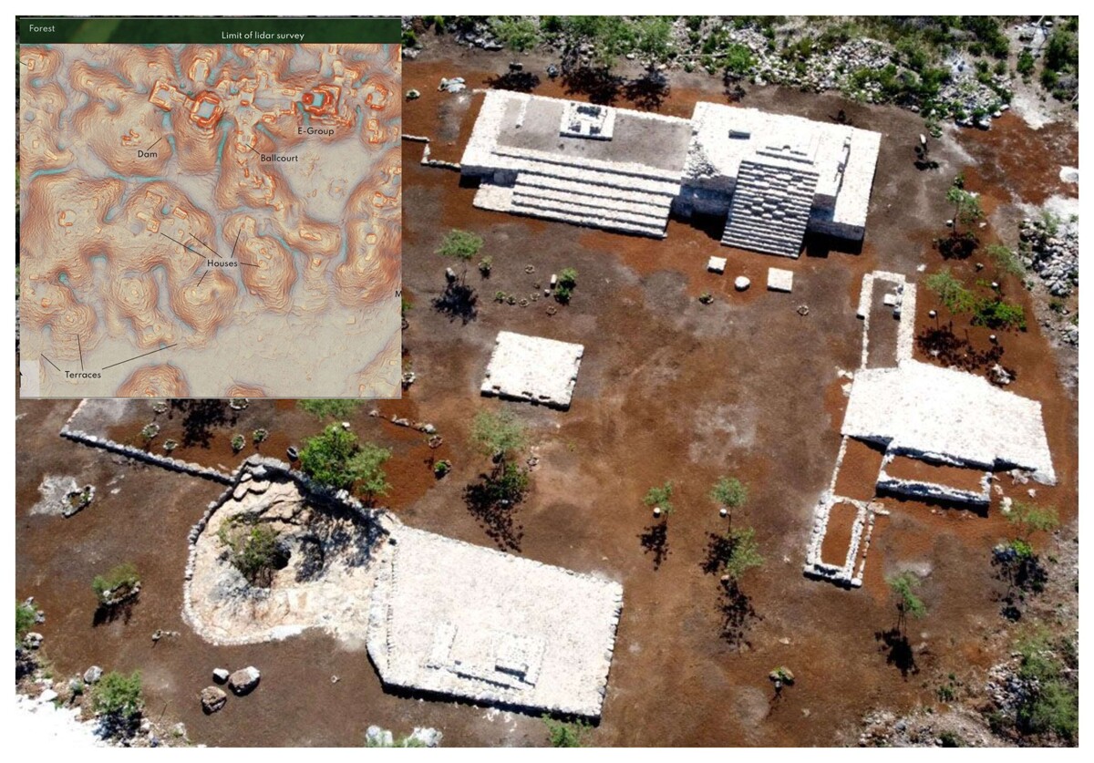
A study published in the journal Antiquity reveals the discovery of an unknown Mayan city in the jungle of Campeche, Mexico. The city, named Valerianan, has six thousand 674 structures, including monumental pyramids similar to those of Chichén Itzá and Tikal. Researchers detail that Valerianan has closed plazas connected by wide causeways, temples, and a ball game court, making it the second largest Mayan site in Latin America after Calakmul.
This city, dating from the classic period (250-900 AD), is described as a 'classic Mayan political capital.' Its discovery was made possible by the use of Lidar technology, which allows mapping of structures buried beneath dense vegetation. Luke Auld-Thomas, a researcher at Northern Arizona University, states: 'We not only found rural areas and small settlements but a large city with pyramids, right next to the only road in the area, near a village where people have been farming among the ruins for years.'
Experts highlight the importance of this discovery by revealing that the region had not only rural areas but also urbanized zones where communities interacted, shedding new light on the territorial organization of the ancient Maya in the region. Lidar technology has been essential in scanning vast areas and detecting hidden structures such as pyramids and Mayan homes from remote offices.
The Lidar data that led to the discovery of Valerianan was collected in 2013 by the Mexican firm CartoData using a Riegl LMS-Q780 sensor, processed by the Woods Hole Research Center (WHRC). Despite the advancements, the use of Lidar technology is expensive and funding for studies in unexplored areas of potential Mayan interest is limited, presenting a challenge to expand this research.