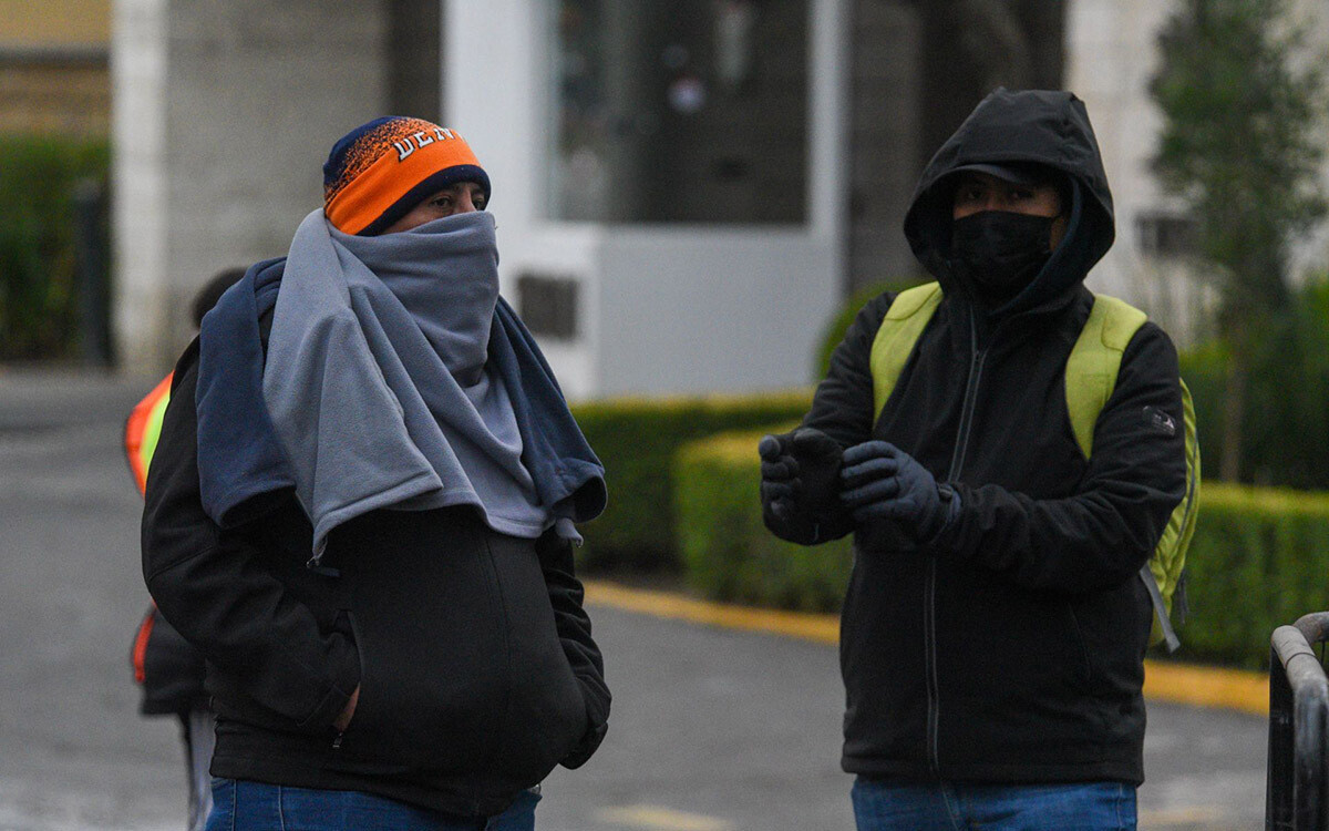
The National Weather Service (SMN) of the National Water Commission (Conagua) reported that cold front number 33 is located over the north of the country and will continue to influence weather conditions for the next 72 hours. According to the latest report, for this Wednesday, the cold front will traverse the northeast and east of the national territory, causing heavy point rains in these regions, as well as showers in entities in the center, south, and southeast of the country. The polar air mass driving the frontal system, in interaction with a trough at altitude and with the subtropical jet stream, will cause a 'Norte' event with winds of 40 to 50 km/h and gusts of 60 to 80 km/h in Tamaulipas and Veracruz. These conditions will extend during the night towards the isthmus and Gulf of Tehuantepec, in Oaxaca and Chiapas, accompanied by high waves on the coasts of Tamaulipas and Veracruz, which will subsequently propagate towards the isthmus and Gulf of Tehuantepec. Additionally, a new drop in temperatures is expected in the north, northeast, east, and center of the country, and during the night, conditions will be favorable for snow or sleet to fall on the summits of Popocatépetl, Iztaccíhuatl, Pico de Orizaba, and Cofre de Perote. On Thursday, the cold front will move rapidly over the southeast of the country and the Yucatan Peninsula, where it will interact with a trough at altitude over the Gulf of Mexico. This interaction will cause heavy to very heavy rains in the east and southeast of the national territory, with intense point rains in areas of Veracruz and Oaxaca. Likewise, the conditions for snow or sleet to fall on the summits of Popocatépetl, Iztaccíhuatl, Pico de Orizaba, and Cofre de Perote will continue. The event of 'Norte' will continue with gusts of 80 to 100 kilometers per hour in the isthmus and Gulf of Tehuantepec, in Oaxaca and Chiapas, as well as gusts of 40 to 60 kilometers per hour during the morning in the east of Yucatán and in Quintana Roo. It is expected that, during the afternoon of Friday, the polar air mass will begin to modify its thermal characteristics, which will favor a gradual rise in temperatures in most of the country, although a cold environment will be maintained during the morning and night in high areas of the Mesa del Norte and the Mesa Central. The polar air mass associated with this system will maintain low temperatures in the states of the north, northeast, center, and east of the country, in addition to a 'Norte' event of strong to intense, with gusts of 100 to 120 kilometers per hour in the isthmus and Gulf of Tehuantepec, in Oaxaca and Chiapas. Additionally, gusts of 80 to 100 kilometers per hour are forecast in Veracruz; 50 to 70 kilometers per hour in Tabasco, Campeche, Yucatán, and Quintana Roo; and 40 to 60 kilometers per hour in Tamaulipas, with high waves on the coasts of these entities. Image: Conagua. For Friday, the SMN forecasts that the cold front will extend over the west of the Caribbean Sea, while the associated polar air mass will cover the north, northeast, center, east, and southeast of the national territory. These conditions will cause heavy rains in Veracruz and Oaxaca, showers in Chiapas, and isolated rains in Puebla and Tabasco.