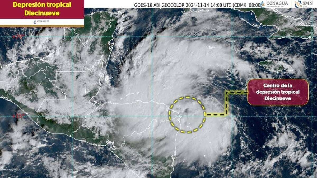
A tropical depression, identified as number 19 of the season, is currently over the western Caribbean Sea, according to the National Water Commission (Conagua Clima) on Wednesday, November 14. With maximum sustained winds of 55 km/h and gusts of 75 km/h, it is located 455 km east of Isla Guanaja, Honduras, and 710 km east-southeast of Puerto Costa Maya, Quintana Roo, currently moving west at 26 km/h.
This tropical depression, potentially transforming into a cyclone, is expected to increase humidity in the Yucatán Peninsula, causing very heavy rains in Campeche, Yucatán, and Quintana Roo, with wave heights of 1 to 2 meters on the coasts of Quintana Roo. According to Conagua Clima, it is projected that depression 19 could evolve into a tropical storm by the afternoon of Thursday, November 15, although still far from the Yucatán Peninsula. It is anticipated to directly impact southeastern Mexico on Monday, November 18, but will decrease back to a tropical depression.
Regarding the rain forecast, on November 14, strong and very heavy precipitation is expected in Campeche, Yucatán, and Quintana Roo, with possible showers in several regions of Mexico, including Tamaulipas, San Luis Potosí, Querétaro, Hidalgo, Puebla, Veracruz, Tabasco, Chiapas, Guanajuato, Michoacán, Guerrero, and Oaxaca, as well as isolated rains in Baja California, Nuevo León, Jalisco, and Colima. On November 15, different states will have similarly adverse conditions, with heavy downpours in Campeche and Quintana Roo, and showers in other entities.
In summary, tropical depression number 19 in the Caribbean Sea poses a scenario of potential impact and intense rains for various areas of Mexico as it moves, generating alerts and preparations for its evolution into a tropical storm in the coming days.