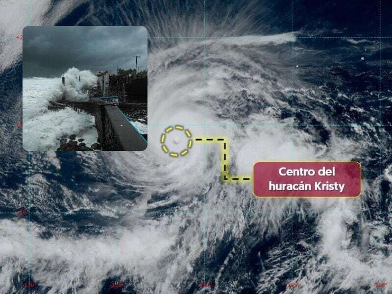
Hurricane Kristy has reached the maximum category, 5, at a distance of 1,565 kilometers southwest of Cabo San Lucas, Baja California Sur. The National Water Commission stated that this hurricane is moving westward, away from the Mexican coasts, with sustained winds of up to 260 kilometers per hour and gusts of up to 315.
According to projections from Conagua, it is expected that by Friday, Kristy will decrease to category 4, and continue losing intensity on Saturday until it reaches category 3, becoming a storm and tropical depression by Sunday, and finally turning into a remnant low pressure on Monday.
Despite its distance from the Mexican coasts, it is important to pay attention to civil protection warnings. When a category 5 hurricane makes landfall, it can produce winds exceeding 250 km/h, causing severe damage to vegetation and structures. The roofs and walls of small houses often collapse, signs and billboards are ripped off and thrown over long distances, while waves can reach heights of six meters and generate floods up to 10 kilometers inland.
Coastal areas suffer severe damage from flooding and debris carried by the waves. In the case of a category 5 hurricane, escape routes are often blocked hours before its arrival, so it is crucial to follow the authorities' instructions in case of any imminent danger.


